The Struve Geodetic Arc is a chain of 265 triangulation survey stations. The Struve Geodetic Arc is stretching from Hammerfest in Norway to a station point close to the Black sea in Ukraine, it passes through ten countries and over 2,820 km. The chain was established and used by the astronomer Friedrich von Struve to determine the exact shape and the size of the earth. Struve carried out his triangulation measurements between 1816 and 1855. The Struve Geodetic Arc is an extraordinary example of scientific teamwork between scientists from different countries. The Tähetorn Observatory is a station point of the Struve Geodetic Arc at Tartu in Estonia. The astronomer Friedrich von Struve was director of the Tartu Tähetorn Observatory from 1820 to 1839. A station point of the Struve Geodetic Arc in Lithuania is located near Meskonys, a small village not far from Vilnius. The UNESCO World Heritage includes 34 of the station points, with different markings, such as drilled holes in a rock, iron crosses, obelisks and buildings. The Tartu Tähetorn in Estonia and Alatornio Church in Finland are the only buildings that were used for the measurements. The 34 station points of the Struve Geodetic Arc gained the status as a UNESCO World Heritage in 2005. Work of Art: Friedrich von Struve.
www.werelderfgoedfotos.nl © Copyright World Heritage Photos

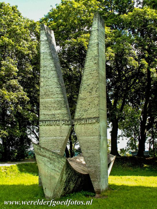
Geodetic Arc of Struve: A monument in Tartu to commemorate the station point and the Arc of Struve. The Geodetic Arc was established and used by the astronomer and geodesist Friedrich von Struve to determine the exact shape and size of the earth. The northernmost point of the Geodetic Arc is situated near Hammerfest in Norway, the southernmost point is situated close to the Black Sea in Ukraine. Friedrich Georg Wilhem von Struve conducted most of his research in the Tähetorn Observatory of the University of Tartu in Estonia.

Geodetic Arc of Struve: A monument in Tartu to commemorate the station point and the Arc of Struve. The Geodetic Arc was established and used by the astronomer and geodesist Friedrich von Struve to determine the exact shape and size of the earth. The northernmost point of the Geodetic Arc is situated near Hammerfest in Norway, the southernmost point is situated close to the Black Sea in Ukraine. Friedrich Georg Wilhem von Struve conducted most of his research in the Tähetorn Observatory of the University of Tartu in Estonia.

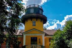
Struve Geodetic Arc: The Tartu Tähetorn Observatory is situated in Tartu, a city in Estonia. The tower is a station point of the Struve Geodetic Arc. Friedrich von Struve was director of the Tartu Tähetorn Observatory from 1820-1839. The Geodetic Arc consists of a chain of 265 triangulation survey stations. The Struve Geodetic Arc is stretching through ten countries and over 2,820 km. The UNESCO World Heritage Site includes 34 of the station points, with different markings. The Tähetorn was built in the beginning of the 1800s. The first heyday of the observatory started in 1813 when Friedrich von Struve began working here.

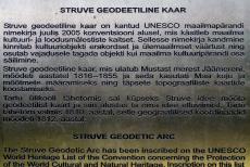
The Struve Geodetic Arc was initiated and used by the astronomer and geodesist Friedrich von Struve to determine the exact shape and the size of the Earth, a basis for making more accurate world maps. The Geodetic Arc consists of a chain of 265 triangulation survey stations. From the 265 station points, 34 station points were declared a UNESCO World Heritage in 2005. The Tartu Tähetorn Observatory and the Alatornio Church in Estonia are the only buildings that were used for the measurements. Other markings are, for example, iron crosses, drilled holes in a rock and obelisks, built especially for this purpose.
