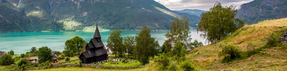
Swiss Tectonic Arena Sardona: Piz Sardona is a mountain in the Glarus Alps, a mountain range in central Switzerland. The 300 km² area around Piz Sardona displays an exceptional example of mountain building through continental collision. The tectonic thrust is a process whereby older, deeper rocks are carried onto younger, shallower rock layers. The Swiss Tectonic Arena Sardona features an enormous break in the Earth's crust, caused by the collision between the continents of Africa and Europe millions of years ago, called the Glarus Overthrust. The Glarus Overthrust is clearly visible in the mountains around Piz Sardona: a clear, razor-sharp line slicing through the slopes. Ancient darker-coloured rocks are clearly seen to overlie lighter rocks that are some 150–250 million years younger. Other natural phenomena in the Swiss Tectonic Arena Sardona include the copper quarry on the Mürtschenalp, the Lochsite, the Tschingelhörner Mountains with the Martinsloch, and various glaciated mountains. The Tectonic Arena Sardona is a natural UNESCO World Heritage Site in the Swiss Alps, just like the Jungfrau-Aletsch. The Swiss Tectonic Arena Sardona gained status as a UNESCO World Heritage Site in 2008.
www.werelderfgoedfotos.nl © Copyright World Heritage Photos

Swiss Tectonic Arena Sardona: Several impressive Alpine giants rise around Piz Sardona. This 3,056-metre-high mountain in the Glarus Alps is situated on the border of the Swiss cantons of Glarus and St. Gallen. The breathtaking landscape around Piz Sardona displays an exceptional example of mountain building through continental collision, a still ongoing process. The Swiss Tectonic Arena Sardona gained status as a UNESCO World Heritage Site in 2008.

Swiss Tectonic Arena Sardona: Several impressive Alpine giants rise around Piz Sardona. This 3,056-metre-high mountain in the Glarus Alps is situated on the border of the Swiss cantons of Glarus and St. Gallen. The breathtaking landscape around Piz Sardona displays an exceptional example of mountain building through continental collision, a still ongoing process. The Swiss Tectonic Arena Sardona gained status as a UNESCO World Heritage Site in 2008.

Swiss Tectonic Arena Sardona: The 3,028-metre-high Trinserhorn is also known as Piz Dolf. Piz Sardona is the small, pointed peak next to the Trinserhorn. The powerful and ongoing collision of the African and European continents resulted, over millions of years, in the formation of the Alps. The older, deeper rock layers were deposited on top of younger, shallower rock layers. The peak of Trinserhorn shows the line of the Glarus Overthrust in its upper part. The 3,247-metre-high Ringelspitz is the highest peak of the Glarus Alps.

Swiss Tectonic Arena Sardona: Piz Segnes shows the line of the Glarus Overthrust. This line is clearly visible in the mountains around Piz Sardona: a clear, razor-sharp and almost horizontal line, slicing through the slopes of the mountains. Usually, younger rocks are deposited on older rocks. However, in this breathtaking tectonic landscape around Piz Sardona, 250–300-million-year-old rocks are resting on 35–50-million-year old rock layers, separated by the line of the imposing Glarus Overthrust.

Swiss Tectonic Arena Sardona: The Tschingelhörner and Piz Segnes in the Glarus Alps. On the slopes of the 3,098-metre-high Piz Segnes, the Glarus Overthrust is clearly visible. East of the main summit of the Tschingelhörner is a 22-metre-high hole named Martinsloch; through this hole, the sun shines twice a year and illuminates the church tower of the village of Elm. Other natural phenomena in the tectonic landscape around Piz Sardona include a geological formation at Lochsite, the copper quarry on Mürtschenalp, and various glaciated mountains and glaciers.

Swiss Tectonic Arena Sardona: The impressive Piz Segnes, Piz Sardona and Trinserhorn viewed from the Cassons mountain station. At the peaks around Piz Sardona, the Glarus Overthrust is clearly visible. In some places within the unparalleled landscape of the Swiss Tectonic Arena Sardona, such as on Fil de Cassons, many people have the feeling of standing in the middle of an arena; this is why this area was given the name Arena. The Swiss Tectonic Arena Sardona was declared a UNESCO World Heritage Site in 2008.

Swiss Tectonic Arena Sardona: In the Glarus Alps around Piz Sardona, darker-coloured rocks dating back 250–300 million years are found on top of lighter rocks that are 35–50 million years old. These two layers are separated by a 40-km-long clear, razor-sharp, almost horizontal line, slicing across the slopes of the mounains. This remarkable phenomenon is known as the Glarus Overthrust. It is one of the largest thrust faults in the world. The Glarus Overthrust is visible over a considerable distance. The Glarus Alps are a major mountain range in the Swiss Alps.

Swiss Tectonic Arena Sardona: The mountain station on Fil de Cassons is situated 2,644 metres above sea level. This mountain, also known as the Cassongrat, is a peak in the Glarus Alps. The mountain station was accessible by cable car until the end of 2015; after that, it was reachable only on foot. But since 2025, a gondola lift has been in operation. The great landscape around Piz Sardona provides an excellent source of knowledge about the formation of mountains. The Swiss Tectonic Arena Sardona is a natural World Heritage Site and was inscribed on the UNESCO World Heritage List in 2008.

Swiss Tectonic Arena Sardona: A Steinmännchen, also called a Steinmandl (Stone Man) near the mountain station on Fil de Cassons, one the peaks in the Glarus Alps. A Steinmännchen is a pile of stones commonly found on the peaks in the Alpine regions and other mountainous areas. Traditionally built by hikers or mountaineers, these cairns serve as trail markers or were erected as summit markers, or warnings for dangerous spots. They are also used as a place to rest or for meditation. From Fil de Cassons, the Ringelspitz (3,247 metres) is visible; this mountain is the highest peak in the Glarus Alps.
